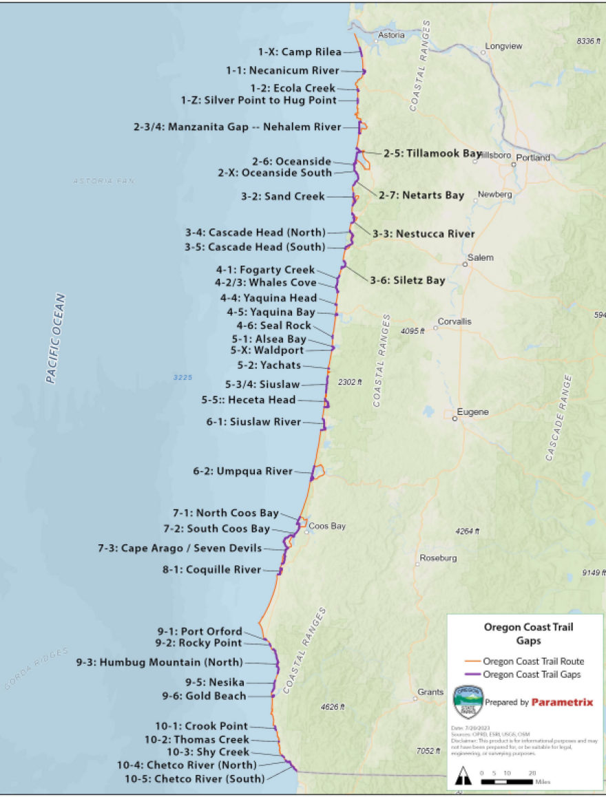
The Oregon Coast Trail Action Plan was years in the making. It includes an assessment of current trail conditions and recommendations for improvements, including connecting gaps that exist in the trail. Cole Grisham is with the Federal Highway Division, which helped with the planning process.
“There’s three types of gaps,” Grisham said. “Areas where the trail was never fully complete and there isn’t really an alignment; areas where the trail is only available perhaps at low tides; or areas where it’s not necessarily safe to hike, such as areas in dangerous parts of U.S. 101, along the side of the road.”

Grisham said in some cases the solution is better signage. Others are more complex.
For example at the Heceta Head tunnel on the central coast, instead of making hikers and bikers traverse the tunnel on Highway 101, the plan sends them inland to walk through the forest then return to the beach.
“Our question was, ‘Is this feasible? Are we actually meeting the intent of the Oregon Coast Trail by cutting inland like this through the forest?” Grisham said. “We used some different data to try and figure out if its viable or not.”
Grisham said they found out people were already using the Forest Service roads to avoid walking on Highway 101.
This plan is a the culmination of over three years of work between Oregon Parks and Recreation Department, the Association of Oregon Counties, Oregon Solutions, and FHWA Western Federal Lands. It was guided by the insight of staff from Oregon DOT, Department of Land Conservation and Development, US Forest Service, US Fish and Wildlife Service, Tribal governments, coastal cities and counties, Oregon Coast Visitors Association, private businesses, and (most importantly) many dedicated recreation users and advocates who know these trails inside and out. It was developed by the staff at Parametrix.
Copyright 2023 KLCC. To see more, visit KLCC.


