Monday, Oct. 25, 1:16 p.m.
Areas across the Sacramento region and Northern California are starting to get a reprieve from Sunday's atmospheric river and bomb cyclone, and a chance to see just how much fell in different parts of the region.
According to the National Weather Service, more than a foot of rain hit Grass Valley in the past 72 hours, the most in the area. Colfax topped 11 inches, while more than 10 inches dropped in Paradise and Pollock Pines, nine inches fell in Quincy and more than 8 inches in Elk Grove. See the full list here.
Placer County officials said evacuations for the Colfax area have lifted after the National Weather Service ended a flash flood warning around the River Fire burn scar. Residents may now return to their homes.
Meanwhile, a winter storm warning is still in effect in the Sierra until 11 p.m. Monday night, and officials are advising people to avoid mountain travel if possible. Donner Pass and Soda Springs have each received more than two feet of snow, and 15 inches have fallen in Kirkwood.
Monday, Oct. 25, 9:32 a.m.
As the rain starts to let up over Sacramento, many roads are still flooded. Residents are not yet in the clear in the foothills and the mountains, as a winter storm warning is still in effect in the Sierra until 11 p.m. Monday night.
📡 Radar update from 8:30 AM: Rain and snow continue this morning for much of interior #NorCal. If you are traveling, be prepared for wet roads and leave yourself extra time to reach your destination. Hazardous travel continues over Sierra mountain passes. #CAwx pic.twitter.com/ZfmaXb3dh2
— NWS Sacramento (@NWSSacramento) October 25, 2021
The snow has already brought chain controls in some areas, and Highway 50 remains closed at Echo Summit because of a rock slide.
But the storm, called a bomb cyclone and atmospheric river by weather officials, did help California when it comes to wildfires and drought.
Daniel Swain, a climate scientist at UCLA, tweeted Monday morning that the storm has put an end to wildfire season. Yesterday fire officials announced the Dixie Fire is 100% contained, and the Caldor Fire was officially contained last week.
NorCal experienced an extreme & in some cases record-breaking rainfall yesterday. There were some flooding issues, plus debris flows in burn areas--but this single event was able to end fire season & (most likely) noticeably reduce drought severity in many places. #CAwx #CAwater
— Daniel Swain (@Weather_West) October 25, 2021
Swain also wrote that the storm will put a major dent in California's ongoing drought, though the state has a long way to go.
"But overall it appears that this event was, on a statewide basis, more beneficial than harmful despite its extremity," Swain wrote.
Monday, Oct. 25, 6:30 a.m.
Sacramento set a new record for most rainfall in a single day Sunday as a relentless early season storm continued to hit the region.
According to the National Weather Service, downtown Sacramento recorded 5.44 inches of rain yesterday, breaking a previous high set in 1880, though records only go back to 1877. A flood advisory stretching from Stockton to Chico has been extended until noon.
The Flood Advisory has been extended until noon Monday as the heavy rainfall continues. Additional rain will result in areas of roadway flooding and continued flooding of small creeks. Never drive through flooded streets! #cawx pic.twitter.com/GeR5hLDtKi
— NWS Sacramento (@NWSSacramento) October 25, 2021
Sierra Littlefield, a meteorologist with the National Weather Service, said the storm has been causing damage and flooding roadways throughout the region. Officials have cautioned people to stay home if they can, or take extra time traveling if they must go out.
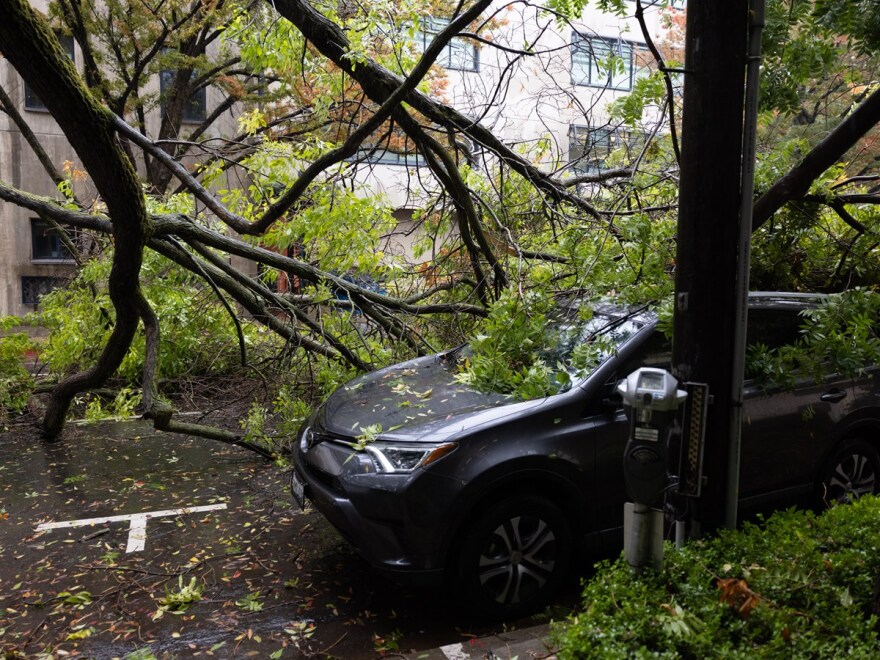
"We saw pretty widespread reports of both downed trees and tree branches, as well as roadway flooding and small creek flooding," Littlefield said. "So definitely, you know, if you see a flooded roadway turn around, don't drown. Water is very powerful, it can be a bit misleading."
Highway 70 remains closed due to a rock slide at the Butte/Plumas County line, and Highway 50 is shut down at Echo Pass because of boulders on the road. Check the latest road conditions on the Caltrans QuickMap.
UPDATE: Boulders will need to be blasted to clear the roadway on Highway 50 over Echo Summit. One-way traffic control for several hours to clear the roadway. ETO is 4 hours for full opening. pic.twitter.com/RwQeW0XF6J
— Caltrans District 3 (@CaltransDist3) October 25, 2021
A flash flood and debris flow advisory around the Caldor Fire burn scar was extended until 9 a.m. Monday.
Littlefield said a storm of this type is unusual so early in the year, and snow is already accumulating over mountain passes. She expects the storm to stay over the region early Monday, but begin to slow down heading into Tuesday.
"So we still have some showers moving across the area this morning, but we will start to see lighter precipitation moving in and we'll start to see some just scattered showers through the day [today] and Tuesday before things really taper off," she said. "We'll see more mild and quiet weather pretty soon here in the next few days."
As of Monday morning, around 130,000 PG&E customers were without power throughout Northern California. The Lake Tahoe Unified School District canceled school Monday because of a power outage. While as many as 30,000 SMUD customers had lost power at points on Sunday, fewer than 50 were without service Monday morning.
Copyright 2021 CapRadio


