


UPDATE: FRIDAY, SEPT. 14, 9:30 a.m. -- Cooler, moister weather conditions are giving fire crews the change to make strong progress in containing the Delta fire. It's grown slightly to just over 60,000 acres and is 28 percent contained.
I-5 remains open and traffic is flowing while repairs are being made to guardrails and other infrastructure damaged by the fire.
NOTE: Since this fire seems to be in hand, we will make further updates to this report only if new developments warrant. To follow the daily updates issued by managers on the Delta fire, follow this link.
Yesterday, federal, state, and local government firefighters achieved 28 percent containment by continuing aggressive fire suppression efforts on the Delta Fire. Control lines held on the west and north edges of the fire, where crews began mopping up, or extinguishing remaining burning material near the control line.
On the northeast edge, crews completed a significant portion of hand and dozer line around the Slate Creek and Shotgun areas. Fire activity within control lines on the east side of Interstate 5, between Sims Road and Gibson Road, resulted in a temporary closure of Interstate 5 due its proximity to the fire. Numerous helicopter water drops successfully extinguished the approximately 20-acre area. Interstate 5 re-opened to through traffic shortly afterwards.
Crews successfully completed dozer line on the northeastern edge of the fire. The containment line connects the western edge of the Hirz Fire near North Salt Creek Road into Hazel Creek. In the southern area of the fire, firefighters focused on building direct fireline using the Sanford Road system below Damnation Peak.
Today, firefighters will continue to construct fireline directly on the fire’s edge between Hazel Creek and Sims Flat area on the east side of Interstate 5. Travelers on the highway are likely to see smoke and/or firefighting operations between Gibson Road and Sims Road exits. Line construction will also continue near Damnation Peak along Sanford Road to tie in the southern edge of the fire. Crews will continue to monitor a small area of activity that occurred overnight on the southeastern edge of the fire near Rabbit Flat.
Weather conditions are favorable for continuing operations along the west and north edges of the fire, where firefighters will continue mop-up operations to strengthen existing control lines. Fifteen helicopters will continue air operations throughout the fire area as conditions allow.
Road Closures/Openings:
Interstate 5 is open with limited traffic control between Redding and Mt. Shasta. All truck load restrictions have been lifted. Ramp closures will remain in effect at Sims Road and Gibson Road due to evacuation orders that are still in effect. Rest areas at O’Brien and Lakehead are now open. Due to re-construction of damaged freeway infrastructure, travelers may be subject to single lane traffic control during daytime hours between Lamoine and Pollard Flat. Motorists are asked to drive with caution and to be aware that emergency vehicles are still in the area. Some of the road systems off of Interstate 5 will remain closed due to suppression efforts. Traffic Control Points will be set at the following areas: Dog Creek/Vollmers off-ramps, both north and south; Pollard Flat off-ramps, both north and south; Gibson Rd off-ramps, both north and south; and the Sims Rd off-ramps, both north and south.
Forest Area Closures:
To provide for public safety during the suppression of the Delta Fire, Shasta-Trinity National Forest lands, roads, and trails around the fire perimeter have been closed under order number 14-18-18. For specific recreation information, please call the Shasta Lake Ranger District at (530) 275-1587 or the Mt. Shasta Ranger Station at (530) 926-4511
Shasta County Evacuations:
The Shasta County Sheriff’s Office has issued mandatory evacuations for residents along the Interstate 5 corridor from exit 707 at Vollmers north to exit 714 at Gibson. Follow the Shasta County Sheriff’s Facebook page: www.facebook.com/Shasta-County-Sheriffs-Office-1527637610823075/
Siskiyou County Evacuations:
The Siskiyou County Sheriff’s Office has issued an evacuation warning, not a mandatory evacuation, for all residents of Dunsmuir. Follow the Siskiyou County Sheriff’s Office Facebook page: www.facebook.com/SiskiyouCountySheriff.
Trinity County Evacuations:
The Trinity County Sheriff's Office has issued a mandatory evacuation notice for residents of East Fork Road to Ramshorn Road east to the Shasta Trinity County line. There will be a hard road closure at East Side Road and East Fork Road for nonresidents. There is an evacuation advisory only from the East Fork/East Side Road junction west to Highway 3 northward to Ramshorn Road. Follow the Trinity County Sheriff’s Office Facebook page: https://www.facebook.com/Trinity-County-Sheriffs-Office-1635934306689276/
Evacuation Shelters:
An evacuation shelter is located at the National Guard Armory at 618 Everitt Memorial Hwy in Mount Shasta, California. The Redding Shelter is on standby located at 100 Mercy Oaks Drive in Redding, California.
Small Animal Shelter:
The Siskiyou Humane Society is housing dogs and cats for evacuees using the evacuation shelter. The humane society is at 1208 North Mount Shasta Blvd (530-926-4052). Evacuees can bring their pets and visit/feed/feed them during the shelter hours of operation (9 a.m. to 4 p.m.). Evacuees are responsible for taking care of their own animals every day.
UPDATE: THURSDAY, SEPT. 13, 10:00 a.m. -- Aggressive firefighting tactics are making slow progress on containing the Delta fire, which is now at 58,427 acres and is 17 percent contained.
I-5 is open, with single-lane traffic control during the daytime hours between Lamoine and Pollard Flat. Truck restrictions have been removed and two rest areas which had been closed, at O'Brien and Lakehead, are now open.
Yesterday, favorable weather conditions helped firefighters in constructing fireline directly along the fire’s perimeter. Increased smoke in the afternoon prohibited aircraft operations over the fire. Ground crews held and improved existing firelines and increased containment to 17 percent. Firelines were completed in key areas along the fire perimeter both east and west of Interstate 5.
On the north end of the fire, crews were successful in securing line around a previously established spot fire near Highland Lakes. In the southeast near Fenders Ferry Road firefighters utilized the Hirz Fire perimeter to stop the fire’s spread. As anticipated, the fire continued to back downhill towards this line, which produced a majority of the visible smoke yesterday.
The fire progressed to the southwest and across the north fork of Dog Creek. Firefighters plan to utilize the Sanford Pass Road system to hold the fire in order to minimize natural resource impacts. In preparation, crews manually cleared vegetation along the road and inserted hose lays to aid firefighters.

Today, firefighters will continue with aggressive suppression tactics as they secure primary control lines around the fire. Crews will also focus on improving current fire lines mopping up hot spots along the fire’s edge. Predicted weather conditions indicate cooler temperatures, higher relative humidity, and light winds, which will reduce fire behavior and minimize growth.
Community Meeting:
A community meeting will be held tonight, September 13, at 6 p.m. at the Dunsmuir Elementary School at 4760 Siskiyou Ave, Dunsmuir, CA.
Road Closures/Openings:
Interstate 5 between Redding and Mt. Shasta is open with limited traffic control. All truck restrictions have been lifted. Ramp closures will remain in effect at Sims Road and Gibson Road due to evacuation orders that are still in effect. Rest areas at O’Brien and Lakehead are now open. Due to re-construction of damaged freeway infrastructure, travelers may be subject to single lane traffic control during daytime hours between Lamoine and Pollard Flat. Motorists are asked to drive with caution and to be aware that emergency vehicles may be in the area. Some of the road systems off of Interstate 5 will remain closed due to suppression efforts. Traffic Control Points will be set at the following areas: Dog Creek/Vollmers off-ramps, both north and south; Pollard Flat off-ramps, both north and south; Gibson Rd off-ramps, both north and south; and the Sims Rd off-ramps, both north and south.
Forest Area Closures:
To provide for public safety during the suppression of the Delta Fire, Shasta-Trinity National Forest lands, roads, and trails around the fire perimeter have been closed under order number 14-18-18. For specific recreation information, please call the Shasta Lake Ranger District at (530) 275-1587 or the Mt. Shasta Ranger Station at (530) 926-4511.
Shasta County Evacuations:
On Wednesday, September 12, 2018, the Shasta County Sheriff’s Office lifted mandatory evacuations and residents were allowed to return home in the following areas: Re-entry to Delta Rd, L Moine Rd, Delta School Rd, Pollard Flat area, Slate Creek Rd, Little Slate Creed Rd, Eagles Roost Rd, Eviesbrood Rd, and Coyote Pass Rd. Areas are open to residents only and those entering will be required to provide documentation to verify residency. For more information about evacuations in Shasta County, call the Shasta County Sheriff’s Office at (530) 245-6025 or follow the Shasta County Sheriff’s Facebook page: www.facebook.com/Shasta-County-Sheriffs-Office-1527637610823075/
Siskiyou County Evacuations:
The Siskiyou County Sheriff’s Office has issued an evacuation warning, not a mandatory evacuation, for all residents of Dunsmuir. Follow the Siskiyou County Sheriff’s Office Facebook page: www.facebook.com/SiskiyouCountySheriff.
Trinity County Evacuations:
The Trinity County Sheriff's Office has issued a mandatory evacuation notice for residents of East Fork Road to Ramshorn Road east to the Shasta Trinity County line. There will be a hard road closure at East Side Road and East Fork Road for nonresidents. There is an evacuation advisory only from the East Fork/East Side Road junction west to Highway 3 northward to Ramshorn Road. Follow the Trinity County Sheriff’s Office Facebook page: https://www.facebook.com/Trinity-County-Sheriffs-Office-1635934306689276/
Evacuation Shelters:
An evacuation shelter is located at the National Guard Armory at 618 Everitt Memorial Hwy in Mount Shasta, California. The Redding Shelter is on standby located at 100 Mercy Oaks Drive in Redding, California.
Small Animal Shelter:
The Siskiyou Humane Society is housing dogs and cats for evacuees using the evacuation shelter. The humane society is at 1208 North Mount Shasta Blvd (530-926-4052). Evacuees can bring their pets and visit/feed/feed them during the shelter hours of operation (9 a.m. to 4 p.m.). Evacuees are responsible for taking care of their own animals every day.
UPDATE: WEDNESDAY, SEPT. 12, 10:00 a.m. -- Firefighters are getting a break from the weather, which is helping them make good progress on the Delta fire along the I-5 corridor in Shasta and Trinity Counties. The fire grew only about 500 acres since yesterday. It currently stands at 53,837 acres and is up to 15 percent containment.
Fire managers say aggressive fire suppression activities were very successful yesterday. Contained areas include a section near Boulder Creek in the northeast and on Fenders Ferry Road in the southeast.
Winds did not increase yesterday as forecasted. The Red Flag Warning, originally in effect until 8 a.m. today, is cancelled.
Clear morning skies allowed for water and retardant drops on the eastern edge in the Sims Road area. Overnight, crews in this area completed fireline down to a frontage road west of Interstate 5. Crews continued to hold and construct new firelines in Hazel Creek, Fenders Ferry, and Dog Creek areas. A large column seen from Redding last night was a result of the fire consuming unburned fuels within control lines above Fenders Ferry Road.
In the north, crews completed a large section of dozer line southwest of Highland Lakes to Gozem Peak. Firefighters successfully completed line around a spot fire in this area to push the fire back toward the fire’s edge.
On the western edge, firefighters have been able to directly attack the fire in the Damnation Peak and Fools Gulch areas. There was limited to no growth in these rocky areas. Control lines continue to hold in the Dog Creek area.

Today, firefighters will focus on aggressively attacking the fire in the north/northeast area near Shotgun and Hazel Creek Roads. The fire continues to grow slowly in this area and is within control lines. Crews will extend existing handline assisted by dozers where the terrain allows. Work will also continue on additional contingency or backup firelines further out.
Aircraft will continue to drop water and retardant on the western edge of the fire where steep, rocky terrain limits access. Air operations will continue to support efforts in the Sims Road and Hazel Creek areas to the north/northeast as conditions allow.
Interstate 5 between Redding and Mt. Shasta is open. Travel is reduced to one lane in each direction for approximately seventeen miles. Motorists are asked to drive with caution, obey all traffic control operations and be patient. Lengthy delay. Vehicles with flammable external loads must use an alternative route.
UPDATE: TUESDAY, SEPT. 11, 10:00 a.m. -- Fire crews are making progress in limiting the growth of the Delta fire, but dry, windy weather forecast for mid-week could test the containment lines that have been established.
On Monday, fire growth occurred primarily in the evening and overnight in the northeast/southeast areas of the fire. Activity on the northwestern edge slowed as the fire reached rocky terrain and limited fuels.
In the north, firefighters continued efforts to minimize impacts to Interstate 5 with burning operations south of Hazel Creek Road and in the Sims Flat area. Work on dozer lines along Middle Ridge progressed to strengthen this contigency line for the northern edge of the fire.
On the southern edges, ground and aerial operations were successful in stopping the forward progress of the fire in the Fenders Ferry and Dog Creek areas. Firefighters completed structure protection by directing fire around structures in the Dog Creek Area. Crews continued efforts building firelines directly on the fire’s edge as well as further south in the southwest area near Damnation Peak.

The wind is expected to affect the fire area today and tomorrow. A red flag warning is in effect from 1 p.m. today to 8 a.m. on Wednesday for shifting and stronger winds. Gusts could reach up to 25 miles per hour. Fire activity is likely to increase, with winds descending below ridge tops. Crews will pay close attention to drainages on the southeast and southern areas of the fire. Topographic features and terrain in these areas could lead to growth in the south/southeast directions.
Today, firefighters will focus on primary control lines and structure defense at the north and south edges below Hazel Creek and Sims Flat and above Dog Creek and Fenders Ferry Roads. Crews are continuing to work on contingency lines in both areas. These lines provide alternatives in case stronger, shifting increase fire activity.
Aircraft will continue to work primarily on the western edge of the fire to strength control lines and limit growth toward the Trinity Lake area. Hand crews are also working to improve direct lines and completing contingency lines in this area.
Road Closures/Openings:
Interstate 5 between Redding and Mt. Shasta is open. Travel is reduced to one lane in each direction for approximately seventeen miles. Motorists are asked to drive with caution, obey all traffic control operations and be patient. Lengthy delay. Flammable vehicles are not allowed.
Forest Area Closures:
To provide for public safety during the suppression of the Delta Fire, Shasta-Trinity National Forest lands, roads, and trails around the fire perimeter have been closed under order number 14-18-18. For specific recreation information, please call the Shasta Lake Ranger District at (530) 275-1587 or the Mt. Shasta Ranger Station at (530) 926-4511.
Shasta County Evacuations:
The Shasta County Sheriff’s Office has issued mandatory evacuations for residents along the Interstate 5 corridor from exit 707 at Vollmers north to exit 714 at Gibson. Follow the Shasta County Sheriff’s Facebook page: www.facebook.com/Shasta-County-Sheriffs-Office-1527637610823075/
Siskiyou County Evacuations:
The Siskiyou County Sheriff’s Office has issued an evacuation warning, not a mandatory evacuation, for all residents of Dunsmuir. Follow the Siskiyou County Sheriff’s Office Facebook page: www.facebook.com/SiskiyouCountySheriff.
Trinity County Evacuations:
The Trinity County Sheriff's Office has issued a mandatory evacuation notice for residents of East Fork Road to Ramshorn Road east to the Shasta Trinity County line. There will be a hard road closure at East Side Road and East Fork Road for nonresidents. There is an evacuation advisory only from the East Fork/East Side Road junction west to Highway 3 northward to Ramshorn Road. Follow the Trinity County Sheriff’s Office Facebook page: https://www.facebook.com/Trinity-County-Sheriffs-Office-1635934306689276/
Evacuation Shelters:
An evacuation shelter is located at the National Guard Armory at 618 Everitt Memorial Hwy in Mount Shasta, California. A second evacuation shelter is located at Mercy Oaks at 100 Mercy Oaks Drive in Redding, California.
Small Animal Shelter:
The Siskiyou Humane Society is housing dogs and cats for evacuees using the evacuation shelter. The humane society is at 1208 North Mount Shasta Blvd (530-926-4052). Evacuees can bring their pets and visit/feed/feed them during the shelter hours of operation (9 am to 4 pm). Evacuees are responsible for taking care of their own animals every day.
UPDATE: MONDAY, SEPT. 10, 9 a.m. — The Interstate 5 freeway in Northern California is now open, which had been closed since Wednesday due to the Delta Fire. That wildfire near Redding is burning more than 47,000 acres and is just 5 percent contained.
The Oregon Department of transportation says to expect delays and congestion as authorities guide vehicles through the Delta Fire zone.
For more information on the freeway, visit the CalTrans website.
UPDATE: MONDAY, SEPT. 10, 7:30 a.m. --- Yesterday, heavy smoke helped keep a damper on the Delta fire. It grew by less than 500 acres by the end of the day. It’s at just shy of 41,000 acres and is still at 5 percent containment.
Interstate 5 remains closed until further notice, with no anticipated re-opening time.
Weather conditions cleared Sunday afternoon and the fire got more active. The fire is moving mostly toward the southwest – toward the Carr fire. It’s also moving toward the north/northwest, toward Trinity Lake.
The Delta fire is burning between the Carr Fire — which has been 100 percent contained for about a couple of weeks now — and the Hirz fire, which has been burning north of Shasta Lake and is 95 percent contained.
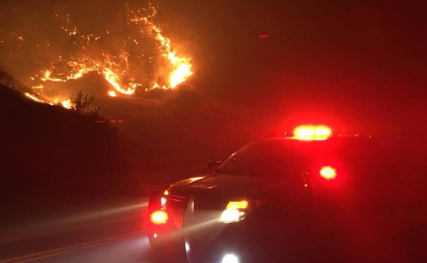
A 45-mile stretch of the Interstate 5 freeway in Northern California had been closed in Shasta County Wednesday afternoon. Drivers had to abandon their vehicles, leaving more than a dozen semi-trailer trucks strewn across the major roadway. Flames raged nearby.
The multi-day shutdown complicated trips for truckers and travelers. The winding detour through this mountainous county added several hours to their trips.
At least one small town has experienced a positive result from the I-5 detour. Travelers have to wind through Burney, California, before heading back to the freeway. Business owners say they've been hit by crowds and increased business.
One of the fire managers’ main strategies is to use old containment lines that were built for the Carr and Hirz fires to funnel the Delta fire’s east and south sides into the already-burned perimeters of the two older fires, using those burned areas to contain the Delta fire. On the east side, at least, that seems to be working. The Delta fire has been joined with the Hirz fire on a growing part of the Delta fire’s east side.
Evacuations are still in place in Shasta County mostly along the I-5 corridor, and in Trinity County, as the fire moves in that direction. There have been reports of some homes lost, but there’s been no official count as of yet. No casualties have been reported.
The fires are making for really bad air quality in that area. Reddding and Dunsmuir have air rated “Unhealthy” this morning. Lakehead – which is right in the middle of it -- has air rated "Hazardous."
The latest word from CalTrans is that I-5 will remain closed until further notice. There had been talk of opening it over the weekend, but that’s been put on hold until the 45-mile stretch between about 10 miles north of Redding to just south of Mount Shasta has been made safe for traffic. For one thing, here’s still active fire in places near the highway. There’s also been a lot of damage to signs, guardrails, fences and, in places, to the road itself. There’s also a lot of concern about tall trees that have been weakened by the fire and could fall across the highway.
There’s no indication at this point when I-5 might open. For the time being, traffic will continue to be detoured onto State Highways 89 and 299.
UPDATE: SUNDAY, SEPT. 9, 10:00 a.m. -- The Delta fire continues to grow along the I-5 corridor in nothern California. The fire has now burned nearly 41,000 acres and is 5 pecent contained.
Transportation officials have not yet re-opened Interstate 5, which has been closed since Wednesday from 10 miles north of Redding to just north of Dunsmuir. They say they are re-evaluating the safety of that 45-mile long stretch of highway and will re-open it when it's safe to do so.
Firefighters achieved the first five percent of containment on the Delta Fire after tying in a large section of the eastern edge with the Hirz Fire. Active fire growth continued under heavy smoke cover and lower than forecasted humidity. Crews are continuing to focus on holding primary control lines and protecting threatened homes, communities, and natural resources.
Engines and hand crews are working on structure protection on the western flank of the fire near Trinity Lake. Fire activity is beginning to back down in this area as it transitions into lighter fuels. Air operations will continue here and in other areas as needed and as conditions allow. A temporary flight restriction continues to be in effect over the fire area.

Active burnout operations continue along the north and northeastern edges of the fire. New fire activity occurred primarily in drainages south of Middle Ridge. Crews will focus on tying this area in with a frontage road directly west of Interstate 5 to support stabilization of the northern section of the affected highway corridor.
Firefighters are continuing structure protection efforts to direct fire activity around buildings in the Highland Lakes area. Additional crews are continuing to strengthen and improve control lines south of Middle Ridge and Sweetbriar Ridge as contingency options.
Firefighters focused on putting out short-range spot fires and completing burnout operations above Dog Creek Road in the southeast area. Efforts in this area continue to focus on primary control lines to limit growth toward the communities of Riverview, Pollock, and Lakehead. Crews are continuing to prepare Carr Fire contingency lines as control for southwest progression of the Delta Fire.
Shasta County Evacuations: The Shasta County Sheriff’s Office has issued mandatory evacuations for residents along the Interstate 5 corridor from exit 707 at Vollmers north to exit 714 at Gibson. Follow the Shasta County Sheriff’s Facebook page. Siskiyou County Evacuations: The Siskiyou County Sheriff’s Office has issued an evacuation warning, not a mandatory evacuation, for all residents of Dunsmuir. Follow the Siskiyou County Sheriff’s Office Facebook page.
Trinity County Evacuations: The Trinity County Sheriff's Office has issued a mandatory evacuation notice for residents of East Fork Road to Ramshorn Road east to the Shasta Trinity County line. There will be a hard road closure at East Side Road and East Fork Road for nonresidents. There is an evacuation advisory only from the East Fork/East Side Road junction west to Highway 3 northward to Ramshorn Road. Follow the Trinity County Sheriff’s Office Facebook page:
Evacuation Shelters: An evacuation shelter is located at Mercy Oaks, 100 Mercy Oaks Drive in Redding, California. A second evacuation shelter is located at the National Guard Armory, 618 Everitt Memorial Hwy in Mount Shasta, California.
Small Animal Shelter: The Siskiyou Humane Society is housing dogs and cats for evacuees using the evacuation shelter. The humane society is at 1208 North Mount Shasta Blvd (530-926-4052). Evacuees can bring their pets and visit/feed/feed them during the shelter hours of operation (9:00 a.m. to 4:00 p.m.). Evacuees are responsible for taking care of their own animals every day.
UPDATE: FRIDAY, SEPT. 7, 3:30 p.m. -- CalTrans officials say I-5 will remain closed until at least Sunday morning. The highway is closed 10 miles north of Redding at Fawndale Road and 3.6 miles south of Mount Shasta at Mott Road.
Denise Yergenson with CalTrans says the fire is still active along parts of I-5 and that there are many burned trees that pose a falling hazard to motorists.
CalTrans will be doing repair and tree removal over the next couple of days and will re-evaluate the safety of re-opening the highway on Sunday morning.
Until then, the detour route using State Highways 299 and 89 is recommended.
UPDATE: FRIDAY, SEPT. 7, 9:30 a.m. -- The Delta fire grew to 24,558 acres overnight, and Interstate 5 remains closed for a 45 mile stretch between Redding and Mt. Shasta.
Fire crews are making progress in their efforts to tie the expanding fire to the existing burn areas of the nearby Carr and Hirz fires, but containment remains at zero percent.
CalTrans has cleared the burned vehicles from I-5 but officials remain concerned about tall trees along the road which may have been weakened by the fire and could fall across traffic lanes. This morning, CalTrans is evaluating those hazards and is hoping to open the highway later today. Traffic on the detour routes -- State Highways 299 and 89 -- remains heavy, at times gridlocked. The normally one-hour drive between Mt. Shasta and Redding is reported to be as long as 5 hours plus.
An atmospheric inversion has held a heavy layer of smoke close to the ground this morning. That's resulted in Air Quality Index readings ranging from "Very Unhealthy" to "Hazardous" in nearby communities. That inversion has also helped dampen the fire, resulting in a slower advance.
A community meeting is scheduled for Dunsmuir this evening at 6:00, to be held in the gymnasium of Dunsmuir High School. It will also be streamed on the Shasta-Trinity National Forest's Facebook page.
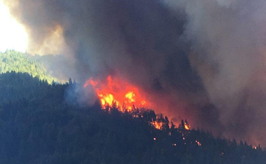
UPDATE: FRIDAY, SEPT. 7, 7:30AM — The Delta Fire continues to burn on both sides of Interstate 5 near the Vollmers Exit north of Lakehead, in Shasta County. It is progressing primarily to the north and is burning actively in brush and timber in steep terrain. As of Thursday night it had grown to more than 22,000 acres.
Interstate 5 remains closed 10 miles north of Redding at Fawndale Road to 3.6 miles south of Mount Shasta at Mott Road according to CalTrans. Transportation officials say they will re-open the crucial transportation corridor as soon as it's safe to do so.
Continued hot, dry weather is expected to fuel the fire over the next few days. The I-5 closure has led to traffic backups and long waits, as the normal one-hour drive between Mount Shasta and Redding has been taking more than five hours on detour routes.
The rapidly-growing Delta Fire is burning in the area between the Carr Fire — which swept through Redding in late july — and the Hirz Fire burning north of Shasta Lake. Firefighters are taking advantage of unused containment lines which were built for both those fires. Crews have started to burn back from those lines in an effort to head off the Delta fire's advance.
"That's one way we were able to stop the Hirz fire, where we were using burn-outs, choosing when we did it, enganging hte fire on our terms rather than where it tried to force us," Said Darryl Jones of the U.S. Fores Service. "So that's the same strategy I believe you'll see going forward on this fire."
The Shasta County Sheriff's Office conducted evacuations on both sides of I-5 north of Lakehead to the Shasta/Siskiyou county line. The fire's spread into Trinity County triggered evacuations there, as well. There is an evacuation center located at the Mt. Shasta Community Center, located at 629 Alder St. in Mt. Shasta.
According to fire managers at theShasta-Trinity National Forest, the Delta fire was initially reported as three fires shortly after noon on Wednesday. They quickly grew together, showing extreme fire behavior and a growth rate of up to one mile per hour. The fire front was up to three miles wide on the north side, with flame lengths estimated at 300 feet.
The Delta fire is believed to have been human-caused, but details aren't available at this time.
This is a developing story. More information will be posted as it becomes available.
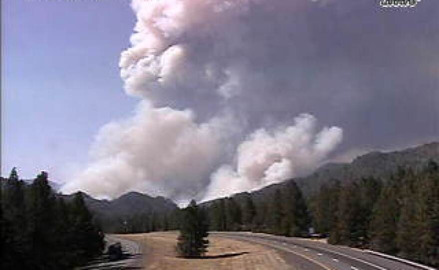
ORIGINAL POST: WEDNESDAY, SEPT. 5, 3:30 p.m. -- A wildfire on both sides of Interstate 5 has closed a nearly 45-mile long stretch of the highway in Shasta County.
Northbound I-5 is currently closed at Fawndale Road, north of Redding. Southbound I-5 is currently closed at Mott Road, north of Dunsmuir, according to theCalifornia Highway Patrol.
The Shasta County Sheriff's Office is conducting evacuations on both sides of I-5 north of Lakehead to the Shasta/Siskiyou county line. According to the Sheriff's Office, an evacuation center will be opening at the Mt. Shasta Community Center, located at 629 Alder St. in Mt. Shasta.
As of 3:30 this afternoon, what's being called the Delta fire had burned 500 acres. By 6:00 p.m., it had grown to 2,000 acres.
Several vehicles have been destroyed on I-5, including at least two large trucks.
The fire is burning in timber and brush, and is exhibiting extreme fire behavior. That means rapid rates of spread and spotting, which throws embers out in front of the fire, lighting new fires as it advances.
Hot, dry conditions with low relative humidity and wind gusts up to 18 mph in the fire area are expected to contribute to continued extreme fire behavior
Fire officials project a rapid rate of spread overnight next 12 hours to the north into Salt Creek and Pollard Flats, east towards Greens Mtn/High Mtn and west towards Damnation Peak and Slate Creek. The anticipate a continued northerly spread impacting additional sections of I-5 and the Union Pacific railway.
Over the next 24 hours, officials anticipate continued spread to the north into Slate Creek, east towards the Hirz fire footprint.
This is a developing story. More information will be posted as it becomes available.
